Levelling Connections, Tanami Region Northern Territory, 1972
In 1972, levelling connections to third order specifications, to selected Aerodist and Theodolite/Tellurometer traverse stations were undertaken in the Tanami region of the Northern Territory. These connections were to enable the heights of the selected stations to be related to AHD. Existing bench marks on the DE and DI level traverses provided initial AHD heights. As required by the specifications, the survey established Permanent Bench Marks along the spur level traverses between the initial bench mark and the destination station.
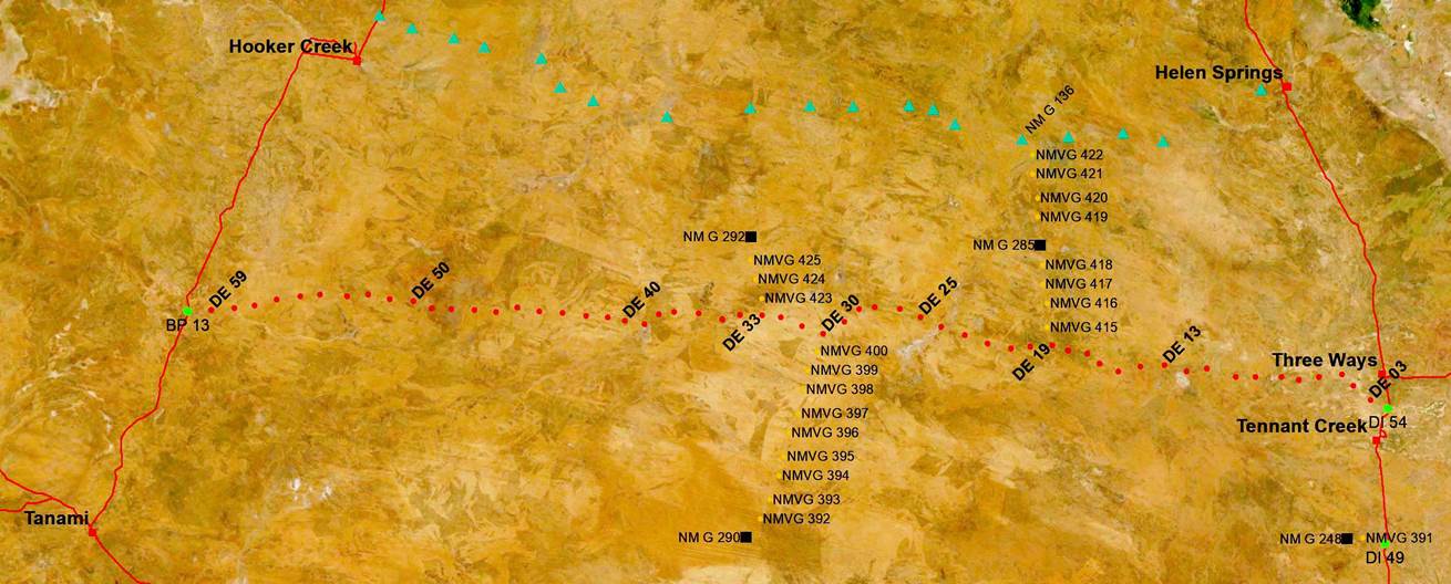
During June, July, and August 1964, Canberra based Survey Technical Officers Norman Francis Vaughan and Carlos Pereira de Lemos from the Survey Branch of the Department of the Interior established the level traverse, designated DE, for the Geophysical Branch of the Bureau of Mineral Resources, Geology and Geophysics as part of the Bureau’s oil search program. The DE level traverse commenced at bench mark DI 54 on the Stuart Highway about 12 kilometres or so south of the Three Ways junction with the Barkly Highway. From bench mark DI 54, the DE level traverse ran generally west for about 470 kilometres to terminate at bench mark BP 13 about 90 kilometres north of Tanami on the Tanami to Hooker Creek track. There were 57 bench marks along the DE traverse (numbers DE 03 to DE 59 inclusive). These bench marks were roughly 8 kilometres apart.
The following survey detail was kindly provided by Dr David Nash, Honorary Senior Lecturer, Linguistics, School of Literature, Languages and Linguistics, Australian National University, Canberra.
The 1972 levelling team, not all of whom were in the field for the whole field season, comprised, as far as it is known, :
|
Barry Sloane (OIC) |
|
Bill Jeffrey |
|
Alan Deck |
|
Adrian Ferguson |
|
Denis Dohnt |
|
Frank Syrch |
|
Kevin Lamb |
|
Phil Allen |
|
Phil Taylor |
|
Ray Halley |
|
Rod Craven |
|
Tony Lewis |
|
Jack Lamb |
|
John Wright |
|
Noel Templeman |
|
Ian Green |
|
Phil Cardiff |
|
Tony Bomford (Assistant Director) and Harry Granger (Senior Surveyor) spent time with the party travelling in a Toyota Land Cruiser |
Operationally, there was a minimum of four parties, each of three people with two vehicles per party (generally C1300 4x4 International trucks). In addition, Barry Sloane, OIC in a Land Rover and a Bedford RLCH 4x4 supply truck.
Some of their work during September/October 1972, is described in the table below and copies of the permanent record of this work may be viewed via this link. In addition, photos and captions supplied by Natmapper Alan Deck may be viewed below and on Dr Nash’s site via the hyperlinks.
|
Permanent Bench Marks Established |
Description as depicted in map below |
|
NMV/G/391 |
from bench mark DI 49, along the Stuart Highway some 26 miles south of Tennant Creek, the connection ran 4.6 miles west of the highway to NMV/G/391, then a further 5 miles to Aerodist station NM/G/248 (constructed 1967).
|
|
NMV/G/392-400 |
from bench mark DE 30, the connection ran 53.7 miles to Aerodist station NM/G/290 (constructed 1968), enroute nine bench marks were established.
|
|
NMV/G/415-422 |
from bench mark DE 19, the connection ran 25.3 miles to Aerodist station NM/G/285 (constructed 1968), enroute 4 bench marks were established; the connection then continued a further 26.2 miles to NM/G/136 a traverse station on the 1966 Helen Springs-Ord River Theodolite/Tellurometer traverse, enroute a further 4 bench marks were established.
|
|
NMV/G/423-425 |
from bench mark DE 33, the connection ran 21.9 miles to Aerodist station NM/G/292 (constructed 1968), enroute three bench marks were established.
|
|
|
Stations on the 1966 Helen Springs-Ord River Theodolite/Tellurometer traverse |
|
|
Aerodist stations |
|
|
Permanent Bench Marks established during the 1972 levelling program |
|
|
Bench Marks comprising the 1964 DE level traverse identified as DE 03 to DE 59 |
|
|
Bench Marks on existing level traverses used for the start or close AHD height |
Map showing the September/October 1972 levelling connections as described above.
Compiled by Paul Wise, August 2021
|
1972 Levelling Operations, Northern Territory Photographs courtesy Alan Deck |
|
|
|
|
|
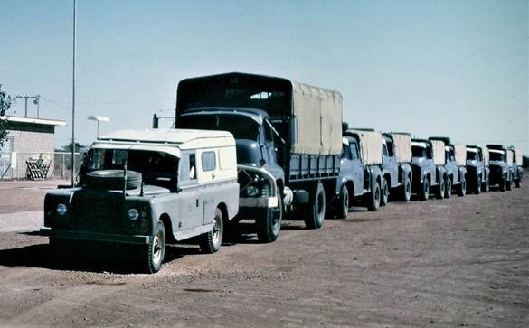
Vehicle convoy at Three Ways, Stuart Highway |
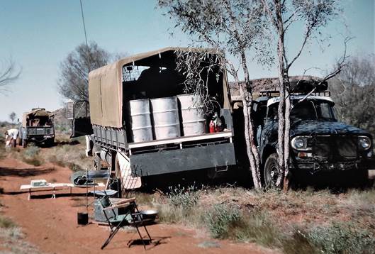
Supply truck near Mount Wedge |
|
|
|
|
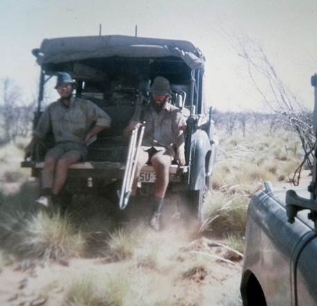
On the tailgate, moving between setups - (L-R) Barry Sloane and Alan Deck |
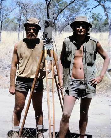
After a morning on the tailgate - (L-R) Alan Deck and Tom Mueller with Jenoptik Koni 007 level on tripod |
|
|
|
|
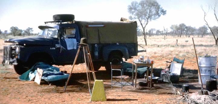
Levelling party camp (yellow box in foreground contains the Koni level) |
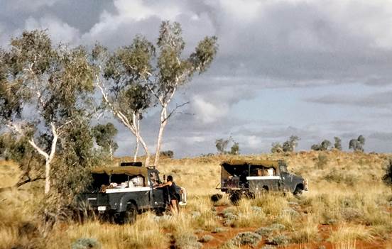
Vehicles of a levelling party in the desert |
|
|
|
|
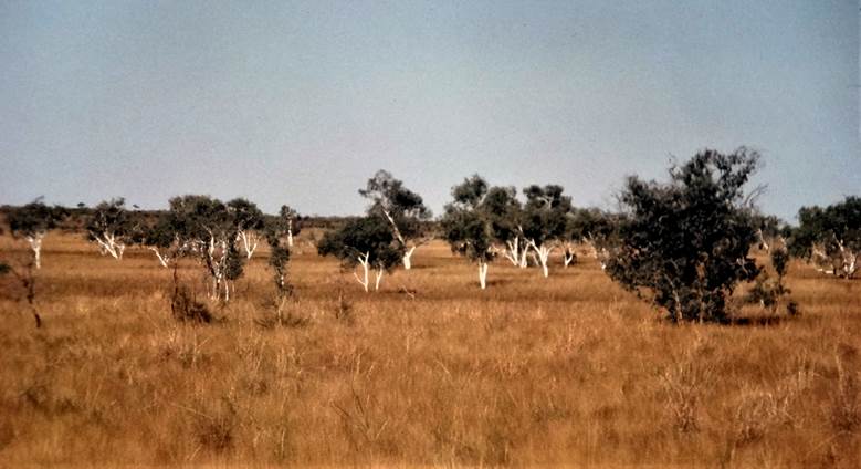
In 1909 Dr Charles Chewings sank a well in an area he called Green Swamp thus Green Swamp Well was named. He recorded that a particularly fine run of large gums occurs to the south of Green Swamp well and while some way away from the well this photograph shows a stand of gums in the general region. |
|